16 April 2013: 30km. Started 08:30. Arrived 15:45.
I was the only B+B guest overnight. The landlady sat and chatted, drinking her tea, while I ate breakfast. The fact that it didn’t seem very organised and slick was explained. She had only been there for about three weeks having just left a pub the other side of Manchester, after the lease wasn’t renewed. The previous landlady had done a sudden flit taking all the bookings with her. Hence, on some days, people were turning up unexpectedly, with longstanding bookings. I was fortunate as I had booked late on after the new landlady arrived. She had plans to restore the hotel to its former glory as a hub of local community and traditions, retaining a link with walkers. She explained that there was an under current of local support for her and this had been exemplified with help offered to her in the snowy weather 2-3 weeks previously.
I departed in very windy conditions and was back on the Pennine Way at Standedge by 09:00. I seemed to be just under a black cloud but luckily it was not emptying any more than a few drops of rain on me. The path was clear with good views; only the wind made it difficult.
I met some people near White Hill – one of them was aiming to climb to the highest point of each traditional county. They suggested I would be better off with a sail – “yes but it would take me the wrong way at the moment as I’m fighting against the wind”. Anyway, my rucksack cover is enough of a sail!
I reached the crossing point of the A672 – seemingly the border of everywhere with a confusing mixture of different county signs. There was a footbridge to cross the M62 – fortunately high sides prevented any risk of being blown on to the speeding traffic below me.

Confusing county signs 
Bridge over motorway
The path went through a conservation area – netting had been laid to help prevent peat erosion and there were piles of flagstones awaiting laying. The views around Blackstone Edge were dramatic and there were some impressive stone outcrops. The path was unclear and I think I veered off course a little. I reached the A58 and saw the White Horse pub – only three hours from Standedge so I could have reached there yesterday. However I’m not sure that there is anywhere to stay.
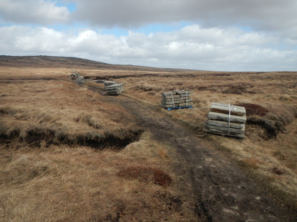
Flagstones dropped from helicopters 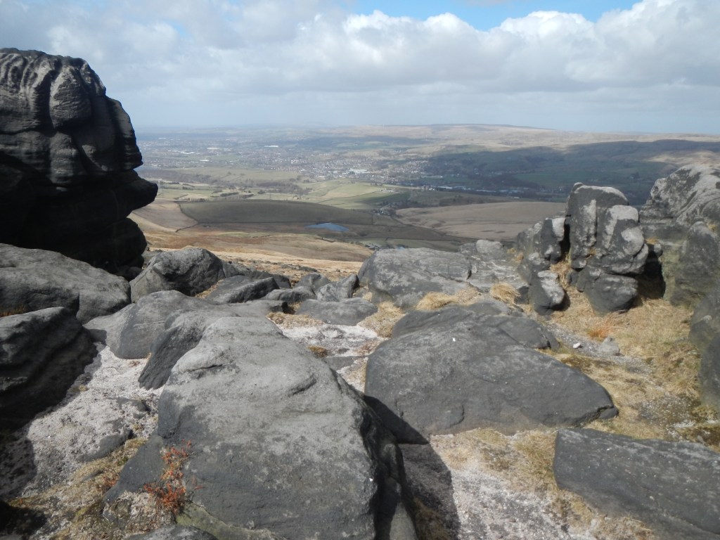
Blackstone Edge
After a short stretch on the busy A58, I was soon on an easily followed track past reservoirs. The wind was becoming even stronger. I met the couple I had seen at the summit of Black Hill as they were debating the route. From where we met, it was possible to see the Stoodley Pike Monument in the distance and I pointed it out to them They explained that they were making for Hebden Bridge a mile off route, whereas I was making for the smaller settlement Jack Bridge with a lesser diversion.
Eventually I reached the exposed Stoodley Pike; the wind made it almost impossible to stand upright, although not as bad as near the Kinder Downfall a couple of days previously. There was a track down to the sheltered valley, crossing the Rochdale Canal. From the main road at Callis Bridge, I climbed up an extremely steep cobbled path and followed footpaths past a field of Highland cattle to reach my final destination.

The B+B hosts made me feel welcome and offered an evening meal as the village pub doesn’t do food and it would be a bus journey down to Hebden Bridge. I had arrived early for the second consecutive day and used the time to scrub, brush and reproof my boots. It was a pleasant spot with views of fields from my comfortable room. I noted that it was not dusk until around 20:30 – I was already calculating how I would manage my very long Malham to Hawes trek in a few days time – setting out around 05:30 / 06:00 at first light should give me time to arrive before dark. I just had to hope for dry weather.
